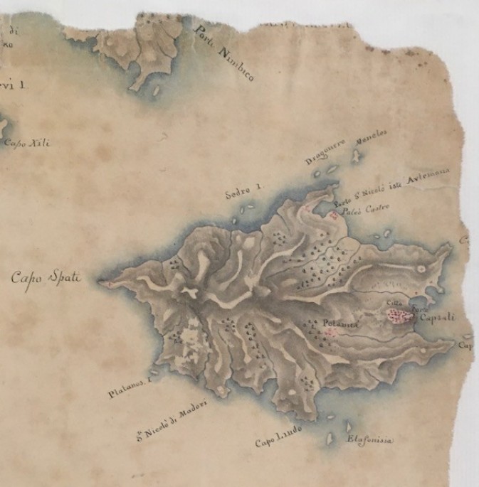
submitted by Elli Petrohilos on 13.10.2023
This is a section of a set of maps of the Ionian Islands, item ref: MR 1/2037/48 held at the National Archives in London. The image isn't available online, but the description is quite detailed giving a date of 1825.
https://discovery.nationalarchives.gov.uk/details/r/C9265500
"Ionian Islands (now part of Greece). 'Piano dell Isole Ionie': map, consisting of 8 joined sheets, of the area between Corfu (Kerkyra) and Cerigo (Kythira), showing roads, waterways, towns, villages and coastal features; also showing the mainland coastline (territory now in Greece and Albania). Reference table. Scale: 13.5 cm to 15 Italian miles.
Hi Maria, the message board wasn't really conceived to be for photos - although perhaps we should...
Looks like I need help on how to upload the image. In the meantime, if you recognise...
Am seeking the help of the wider Kytherian network to investigate their old family photo albums over...
Hi Harold (distant cousin!) Vikki is correct. Velio married Angelo Chlentzos 'Bylos' on 30 Aug 1923 in...
About 5 minutes into the program Ada Margariti, who is an Attorney at Law, speaks about how she came to...
Interviewed during his visit to Australia, 2013.
August 17, 2010 103.2 HOPE - radio station You’ve heard of PhDs in science, medicine and education but have you...
Brisbane kytherians at paliochora excursion ..exploring the wonderful site and seeing all the churches .. this one is called ' e...
Gorgeous Ruby! Ruby's father was Evangelo Megaloconomos born 7 September 1891, died 29 January 1983 Ruby was born 16 September...
04.12.2023 (Message Board)
26.11.2023 (Message Board)