Colour map of Kythira, Italian, 1825, held at National Archives London.
This is a section of a set of maps of the Ionian Islands, item ref: MR 1/2037/48 held at the Nationa...
View Full MessageHistory > Vintage Maps
This is a section of a set of maps of the Ionian Islands, item ref: MR 1/2037/48 held at the Nationa...
View Full Message
One of several maps of Kythira held at the National Archives in London. Unfortunately none of them a...
View Full Message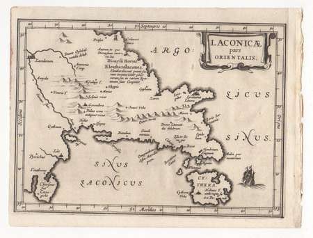
COPPER ENGRAVING MAP LACONICAE PARS ORIENTALIS SIZE: 22x16.50 cm WITH THE ORIGINAL TEXT ACCORDING T...
View Full Message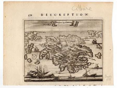
EARLY COOPER ENGRAVING MAP OF CERIGO MAP SIZE: 16x13 cm LEAF SIZE: 22x17 cm FROM THE BOOK NAUK...
View Full Message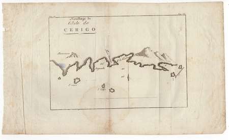
EARLY COOPER ENGRAVING MAP OF CERIGO MAP SIZE: 25x17 cm LEAF SIZE: 40x24 cm FROM THE BOOK VOYA...
View Full Message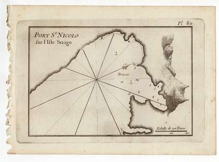
EARLY COOPER ENGRAVING MAP OF CERIGO MAP SIZE: 22x14.50 cm LEAF SIZE: 24x17 cm FROM THE BOOK D...
View Full Message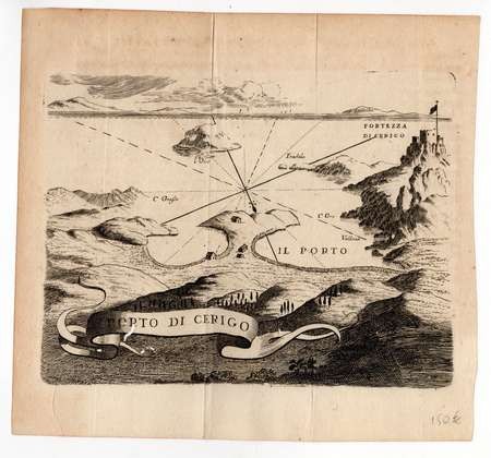
EARLY COOPER ENGRAVING MAP OF CERIGO MAP SIZE: 17x13 cm LEAF SIZE: 19x18 cm FROM THE BOOK MEMO...
View Full Message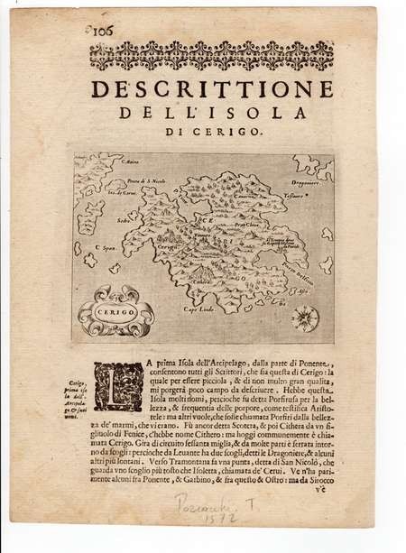
EARLY COOPER ENGRAVING MAP OF CERIGO MAP SIZE: 15x11 cm LEAF SIZE: 28x20 cm FROM THE ISOLARIO...
View Full Message
Position of Pavlopetri - Coordinates: 36°31′01″N 22°59′19″E The city of Pavlopetri, underwater of...
View Full Message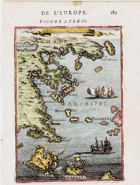
1683 Map of CERIGO Kithira Island 1st ed. by Allain Manesson Mallet
View Full Message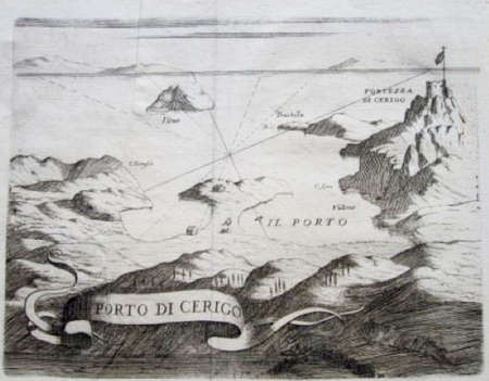
This 300 year old map shows the two bays at Kapsali and the kastro at Hora. Note there is only one s...
View Full Message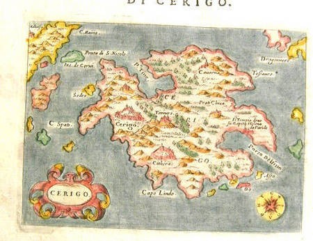
Copperplate engraving by Girolamo Porro (1520 - 1604) published in "L'isole ...", in 1572 in Venice.
View Full Message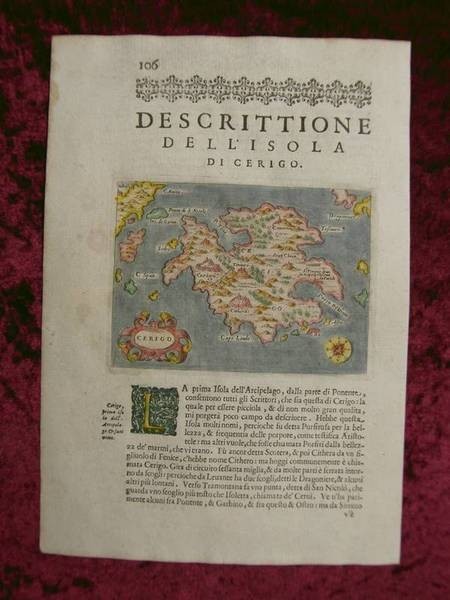
Copperplate engraving by Girolamo Porro (1520 - 1604) published in "L'isole ...", in 1572 in Venice.
View Full Message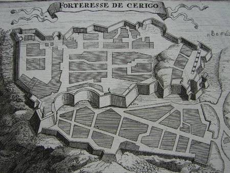
FORTERESSE DE CERIGO copper map by P. Mortier about 1700
View Full Message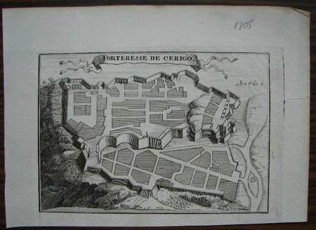
FORTERESSE DE CERIGO copper map by P. Mortier about 1700
View Full Message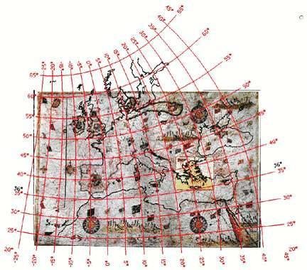
Figure 12. The Sideri’s Mediterranean map and the Vesconte’s map of the Aegean map in a unique obliq...
View Full Message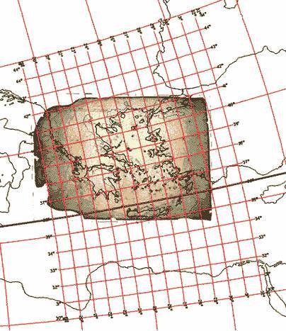
Figure 11. Reis’ map associated to the oblique conic projection and the protocol in Fig. 4. Figur...
View Full Message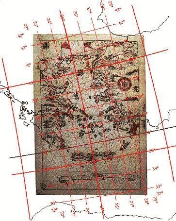
Figure 10. Millo’s map associated to the oblique conic projection and the protocol in Fig. 4. Fig...
View Full Message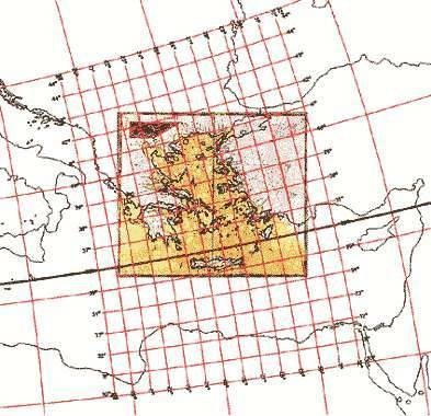
Figure 9. Vesconte’s map associated to the oblique conic projection and the protocol in Fig. 4. F...
View Full Message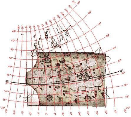
Figure 8. Vourdopoulos’ map associated to the oblique conic projection and the protocol in Fig. 4....
View Full Message