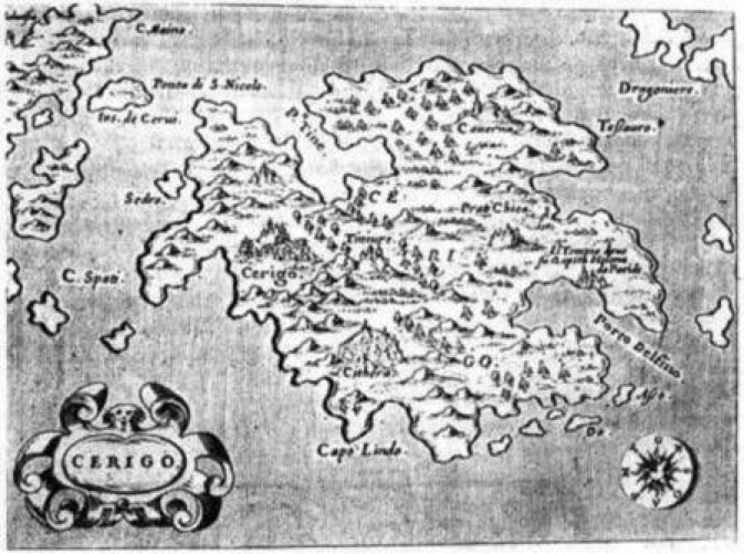
Map of the island of Cerigo, the southernmost Ionian Island, Cythera (Greek:Kythera). Copper plate engraved map on a page from atlas of Tomaso Porcacchi, "Isole del Mondo" published in Padua c1585. (Andronicus - 1576). Relevant text in Italian below the image. 10x13.7cm (4x5 3/8"). Atlas page measures 33x21cm (11 7/8x 8 1/4").
Introduces article on Kytherian stamps by Damian N Andronicus.